
October
2012 Jeep trip to Moab Utah area
On the first day we tried
to get to Hey Joe Canyon but get lost instead. Rather than turning back we
decided to keep going because it was still fun and actually ended up on a large
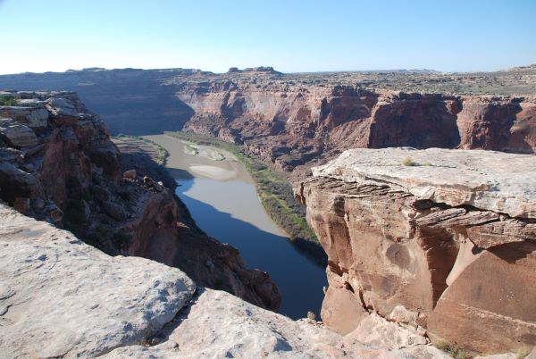
overlook into Labyrinth Canyon at the location N38.6135 W110.0588 see Google
Map. Here there are large rock formations with cliffs sharply
dropping off to the bottom of the canyon with breathtaking views. One spot had
some pools of water that had collected in the rock surfaces. Another dead end
road leads to an overlook where you could see a path to climb down to the river.
It looked kind of difficult with large lose boulders to climb over and plenty of
other obstacles. We then headed back to green river and stayed in the Super 8
Motel.
On the second day after not
getting the best night’s rest but still energetic we headed out again to
locate Hey Joe Canyon. The motel's internet was useful for searching out
waypoints for the proper turns to make. We had success and our final point was
N38.5549 W109.9920 see Google
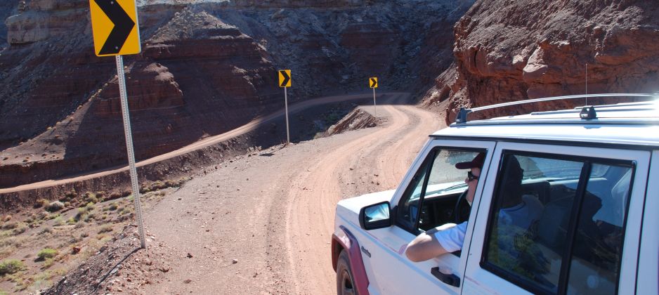
Map where we turned around. This aria had an incredible view from a
descending canyon road, carved out of the rock with many switchbacks. At the
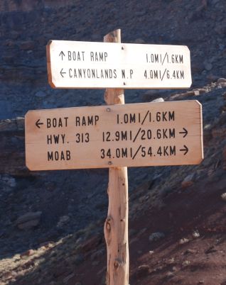
bottom were a boat ramp and airstrip.


Hey Joe Canyon, a site of some mining ruins, is a short tributary to Labyrinth Canyon of the Green River. To get into the canyon, one must travel about 20 miles of pavement and 10 miles of good dirt road to the rim of Spring Canyon, where a spectacular ledge road winds down a 600-foot cliff to the canyon bottom. The trail follows the canyon about 2 miles to the Green River and another 9 miles upstream in Labyrinth Canyon to Hey Joe Canyon. The trail along the river is subject to rockfalls and collapse. Some of the hand-made passages can be difficult for full-size pickups and such. Although the brushy tamarisk alongside parts of the trail is occasionally cut back, fancy paint jobs may prefer another trail. Approximate mileage: 85 total, 45 off highway.
Difficulty Rating: 3 (old 3)
Scenery: The access roads include the paved one in Sevenmile Canyon and good dirt roads in the open plateau country and into Spring Canyon to the Green River. Spring Canyon is a jewel. The trail enters Labyrinth Canyon at Bowknot Bend, a large loop of the river where the river doubles back and threatens to short-cut the loop in the near future, geologically speaking. There are abandoned mining roads on both sides of the river; remains of the cable that ferried equipment across the river may be seen.
Road Surface: The road into Spring Canyon once carried ore trucks and heavy equipment but has been subject to erosion from storms. It is now being maintained as part of the Grand County road system. The roads in Spring Canyon and Labyrinth Canyon are good dirt except where erosion has narrowed them or left rockfalls that were made passable with the least possible labor.
Obstacles: There are no fixed obstacles on this route; the hard places move around as erosion continues. Some of the older rockfalls have been crossed so much that they are getting easy. The road is scary when dry and terrifying (dangerous, too) when wet.
Information courtesy of Red Rock 4-Wheelers, Inc